 |
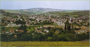
| Panoramic
view of the city |
| |
 |
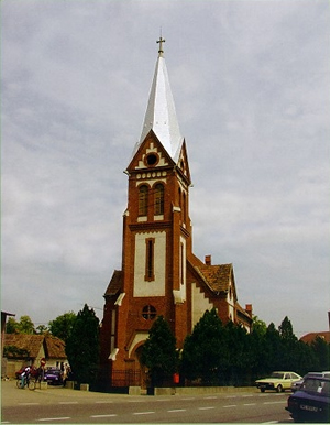
| Roman-catholic
church |
|
Ludus
is located in the western part of the county, on the
two banks of the Mures River, at the confluence with
Pârâul de Câmpie River, as well as
with the road Ludus - Sarmas - Sarmasel. It is situated
45 km west southwest of Târgu Mures, 12 km west
of Iernut, 26 km of Turda and 40 km of Sarmas; it is
a railway station on the route Târgu Mures - Razboieni
and Târgu Mures - Ludus - Sarmasu -Bistrita. Ludus
is the main center of the entire western area of the
Mures County. As an administrative and territorial unit,
it is well balanced, with varied geographic sceneries,
important natural resources and a strong economic potential.
Being the town of "sugar",
it has rapidly grown from a rural settlement into a
town. The old neighborhood is located on the right bank
of the Mures River. The area seems crowded between the
surrounding hills. In the new neighborhood, on the left
bank of the Mures River, the administrative and political
center, the Hospital, the General Clinic, the Industrial
High-School, the Cultural Establishment, the new post
office, the sugar, dairy and rubber processing factories
are located, as well as fabric processing industrial
units and various shops.
The town was mentioned
in documents in 1377 under the name of Ludas and it
was declared town in 1960. Ludus includes only one village
that was dated long ago - Gheja (l366), all the others
being mentioned during the 20th century: Avramesti,
Cioarga, Ciurgau, Fundatura, Rosiori. Traces of material
life were discovered dating from the prehistory. The
18th century was characterized by several uprisings,
the most important one being the anti-Habsburg uprising
led by Francisc Rákoczi the 2nd (1703-1714) and
the peasants' movement from the Ludus area, led by Sofranie.
Ludus' inhabitants took part in great number in the
social movements of 1848. This is the place where the
13th Legion led at first by Batrâneanu, then by
Fl. Micas and N. Vladutiu, was organized.
|

